Exploring Hadrian's Wall
by Teri Foster Gray
 Rome traded with Britain for wool and tin for
hundreds of years before Julius Caesar began the Romanization of
Britain with invasions in 55 and 53BC. Nearly two centuries
later, Rome controlled the bulk of the southern half of the
island, but at a steep price: one out of every ten Roman soldiers
guarding the borders of Rome's sprawling empire served along the
80-mile boundary between Roman Britain and the Pictish North. The
emperor Hadrian, touring the border in 122 AD, decreed that a
wall should be built to simplify this task. The wall served this
purpose for nearly 300 years, until Rome's withdrawal from
Britain in 411 AD. During that period and since, the Wall and the
neighboring forts and towns have become archaeological gold
mines. The district is home, as well, to museums and sites of
non-Roman historical interest. Rome traded with Britain for wool and tin for
hundreds of years before Julius Caesar began the Romanization of
Britain with invasions in 55 and 53BC. Nearly two centuries
later, Rome controlled the bulk of the southern half of the
island, but at a steep price: one out of every ten Roman soldiers
guarding the borders of Rome's sprawling empire served along the
80-mile boundary between Roman Britain and the Pictish North. The
emperor Hadrian, touring the border in 122 AD, decreed that a
wall should be built to simplify this task. The wall served this
purpose for nearly 300 years, until Rome's withdrawal from
Britain in 411 AD. During that period and since, the Wall and the
neighboring forts and towns have become archaeological gold
mines. The district is home, as well, to museums and sites of
non-Roman historical interest.
The Wall was not built to guard against massive attacks from
the north, but to control the flow of people and goods in that
part of the country. The soil is rich in the Border Country, but
the short summers and cool temperatures severely limit
agriculture, making the land sparsely populated even now. Customs
of inheritance, which mandated equal distribution of property
among the heirs, could reduce event the most prosperous homestead
to a scattering of freeholdings in a few generations, with the
inhabitants confronted with the stark choice, "steal or
starve." The Roman Wall, Roman jurisprudence, and the chests
of silver brought in to pay the troops brought stability and a
degree of prosperity to this area for 3 centuries. Once they
left, the region quickly reverted to anarchy, with the Wall
regarded as a convenient source of building material for local
farmers and cheap sculpture for local nobility. Once the legions
pulled back to Gaul, the origins of the Wall were quickly
forgotten. Not until 1840 was it definitively identified as the
Wall decreed by Hadrian.
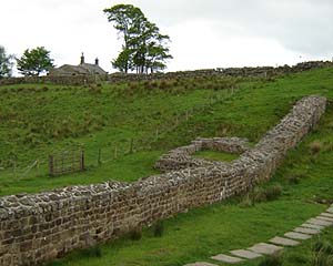 Although fragments of the Wall can be found as far east as
Wall's End near Newcastle, and as far west as Bowness, the
best-preserved section of the Wall lies in the less-populated
center, from Corbridge to Greenhead. Although fragments of the Wall can be found as far east as
Wall's End near Newcastle, and as far west as Bowness, the
best-preserved section of the Wall lies in the less-populated
center, from Corbridge to Greenhead.
Things have changed since the 1600s, when, surveying the wall,
royal surveyors avoided this section for fear of "rankie
robbers." The Wall is now a popular tourist destination and
well served by bus and train. Both Newcastle-on-Tyne at its
eastern end and Carlisle to the west -- fascinating stops in
their own right -- serve as jumping off points via Hadrian's Wall
Bus Service, Route AD122 (3-4 trips per day, June-September,
single trip and Day Rover passes available from the driver); by
public bus (hourly service year-round, every 2 hours on Sunday)
or by train (the same frequency as the public busses, but with
fewer stops).
If you are renting a car, or using a Britrail Ride/Drive pass,
this is a good place to economise. The bus services are
tourist-oriented and reasonably-priced, with point-to-point
fares, day passes, family passes, and student and elder
discounts. You need not chain yourself to one location, or haul
your belongings as you visit the sites. Travelight (Tel. 016 977
2315) and Walkers, Ltd. will, for a modest fee, pick up your
luggage and transport it to your next night's stop. Call the day
before to arrange pick-up.
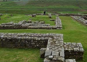
The easternmost of the wall towns, Corbridge is home to the
Corbridge Roman Site, the former garrison town of Corstopitum,
which lies on the west side of town near the river. This, the
oldest Roman garrison in the North, was built in 80 AD as a
supply base for the invasion of Scotland and to guard the
crossing of the Tyne at Stanegate. There you can tour the
foundation of a complete Roman fort: baths, granaries, temples,
the headquarters complex, houses, and workshops.
Four miles west of Corbridge, Hexham's Market Square is
dominated by Hexham Abbey (now the Priory Church of St. Andrew),
originally built in 671 by St. Wilfrid. Once known as the finest
church north of the Alps, it was destroyed by the Vikings and
rebuilt in its present form between 1170 and 1250 as an
Augustinian priory. With admission a non-mandatory £3
donation, the Abbey provides a cross-section of British history:
a foundation of Roman stonework plundered from Corbridge (make
that "salvaged;" Wilfrid, after all, was a saint), a
Saxon-built crypt, the 8th-century Frith stool, and artwork
dating from the 15th century to the present. (Someone has
lovingly needle-pointed matched sets of kneeler cushions, and a
plaque commemorates a widow's bequest of "£3 per year
to be given to the poor at Christmas" in 1829.) You will
need to ask to have the crypt unlocked to view it, and be
careful: It is well lit, but the steps are very steep.
 Nearby,
the Old Gaol, constructed as an ecclesiastical prison in the
early 14th century, is now home to the tourist office and the
Border History Museum, which tells the tale of the
English/Scottish border, the most blood-soaked region in Britain.
(For more information, see Carlisle and the English Marches: Tracing the Border
Reivers by Julia Hickey.) Nearby,
the Old Gaol, constructed as an ecclesiastical prison in the
early 14th century, is now home to the tourist office and the
Border History Museum, which tells the tale of the
English/Scottish border, the most blood-soaked region in Britain.
(For more information, see Carlisle and the English Marches: Tracing the Border
Reivers by Julia Hickey.)
Four miles north of Hexham, Chollerford is home to Chesters Roman
Fort (Cilurnum), the outlines of which are still visible. For 200
years the Ala Asturias, or Second Cavalry Regiment of Asturias,
in Spain, manned Cilurnum. The land there slopes to the east, and
one can see the foundations of the bridge that carried the Wall
across the North Tyne River.
The bath house is particularly well preserved, revealing the
Roman ability to think things through to the last detail. Like
all Roman bath houses, it contains hot, cold, and tepid baths; a
sauna, changing room, and latrine, the last positioned so that
the runoff from the other rooms continually rinsed it. It is also
the most sheltered of the Roman sites, which one learns to
appreciate when hiking the open Northumbrian countryside.
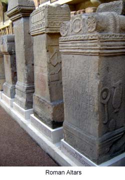
The museum contains numerous examples of Roman stonework and
sculpture excavated by John Clayton, who built Chesters Great
Hall just to the west of the site and did much of the early
excavation. His nephew, J.M. Clayton, inherited the property and
built the museum in order to open his uncle's collection to the
pubic. He bequeathed the grounds and museum to the National
Trust, and its displays stand today just as he arranged them in
1897.
Housteads, eight miles west of Chesters, is home to the most
popular of the Roman forts and an excellent jumping off place for
a hike. Half a mile west, the Pennine Way joins the Wall for a
few miles. You can walk ten miles north to Bellingham, itself a
nexus of bike and hiking paths, or follow the wall westward along
the Whin Sill, where the Wall sits atop a limestone cliff. This
takes you through some of the most spectacular vistas to Steel
Rigg, about three miles to the west.
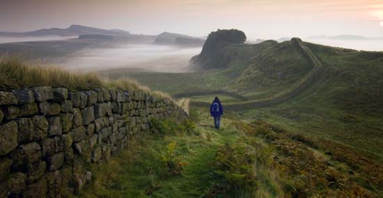
Be warned, however, that this popular walk is not for the
faint-hearted, nor the out-of-shape. Housteads itself is a steep
hike from the car park. Wind-swept does not do justice to
Hadrian's Wall country. There are times when the wind is nearly
substantial enough to sit on.
The quaintly named Once Brewed, a YHA hostel that takes its name
from the neighboring pub, "Twice Brewed," lies half a
mile south of Housteads and offers beds, meals, and coin-op
internet access. Twice Brewed offers the same, and there are
numerous hotels and bed and breakfasts in the area. (Ale, you
see, is brewed twice, while the tea and coffee served at the
Youth Hostel are only brewed once. ) The less creatively named
Once Brewed Tourist Information Center sits on the other side of
the hostel. No meals available there, but the internet access is
free.
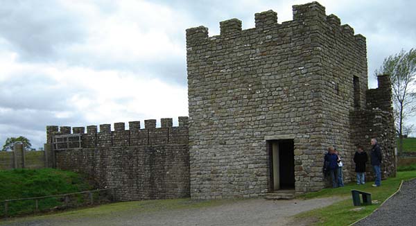
Vindolanda lies another 1.5 miles beyond Once Brewed, toward
the southeast. There, in addition to the usual outlines of
barracks, stables, and headquarters, you will find a recreated
section of the Wall with a mile tower.
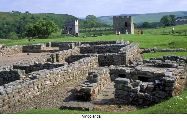
The Vindolanda Museum is a gem. The wet climate, silty soil,
and the Roman habit of dumping their trash into the drainage
ditches have conspired to produce an archaeologist's heaven.
Hundreds of documents -- from paymaster lists to letters from
home -- and thousands of objects (weapons, hairpins, shoes,
tools, even a wig) fill the meandering rooms of the museum. The
gift shop there also has the widest selection of books. The finds
provide a window into the lives of the cavalry who manned the
garrison and the townsfolk they ruled. The archeological staff
there estimate that it will take another century or two to fully
excavate and study the site.
Seven miles east, Great Chesters Fort marks the beginning of
the Walltown Crags, a section of the wall containing a signal
turret that predates the wall. In Carvoran, three miles west of
the Crags, the Roman Army Museum has dioramas of life in a Roman
fort. One can buy a joint ticket that gives admission to both
that facility and Vindolanda.
Birdoswald, 15 miles west
of Once Brewed, is not as developed as other sites, but it does
have two advantages. One is an on-site hostel. (A night at the
hostel buys you free admission to the site.) The other is The
Roman Festival on Bank Holiday Sunday and Bank Holiday, a.k.a
Memorial Day Weekend, where costumed re-enactors drill in
authentic Roman uniforms. In addition, the scenery around
Birdoswald is some of the most spectacular along the Wall.
Related Articles:
- Carlisle and the English Marches: Tracing the Border
Reivers, by Julia Hickey
- https://www.timetravel-britain.com/articles/country/reivers.shtml
More Information:
We regret that we no longer have the resources to maintain up-to-date links and/or hours and pricing details for the various sites and attractions listed on this website. For more information about the location(s) listed above, please use your favorite search engine or visit Wikipedia.
Teri Foster Gray lives in the Pacific Northwest with her husband and Labrador Retriever. A mild-mannered banker by day, she writes novels and travels whenever possible. Her journeys have included two years in Hawaii, six months in Europe, and the British visit that resulted in this piece. She has recently completed a novel, The Shadow Empire.
Article © 2006 Teri Foster Gray
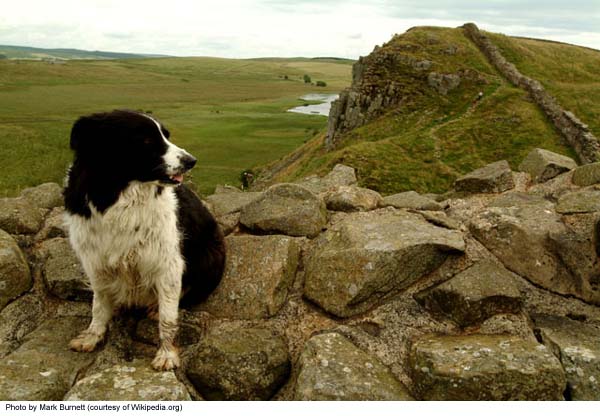
Photos 1-4 © Teri Foster Gray; photos 5 & 6 (hiker, Vindolanda) courtesy of Britainonview.com; dog photo courtesy of Wikipedia.org
|
