Discovering Prehistory on Ilkley Moor
by John Abraham
 With a population of only 14,000 and perched at the
edge of the Yorkshire Dales National Park, the town of Ilkley
retains its Victorian charm in its architecture, tree-lined
streets, and elegant shops and tea rooms. Though it is only 14
miles from Bradford and 17 miles from Leeds, two major
wool-processing cities during the Industrial Revolution, its
history lies much, much farther in the past! With a population of only 14,000 and perched at the
edge of the Yorkshire Dales National Park, the town of Ilkley
retains its Victorian charm in its architecture, tree-lined
streets, and elegant shops and tea rooms. Though it is only 14
miles from Bradford and 17 miles from Leeds, two major
wool-processing cities during the Industrial Revolution, its
history lies much, much farther in the past!
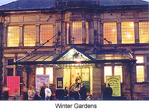
Your first impression of the town might be of a traditional
English seaside resort -- an impression strengthened by the
buildings one sees from Station Road. One such building is the
Winter Gardens, built in 1913, which has received National
Lottery funding in the last couple of years to help stave off the
ravages of time.
If, however, you look in a southerly direction from the town
center, you will see, rolling upwards in the background and
partially obscured by trees, Ilkley Moor. If you decide to take a
walking excursion around the moor and neighbouring areas, I would
advise you to obtain an Ordnance Survey map (The Landranger
series No. 297, "Lower Wharfedale and Washburn
Valley"), to ensure a safe and interesting journey. Follow
Wells Road for a mile and you will come to the foot of the moor,
with its carpet of bracken and stray boulders. One feature that
you'll see halfway up the hill is White Wells cottage.
Prehistory
Most of the Wharfe valley, including where Ilkley is today, was
an inhospitable swamp. The high ground, was inhabited by hunter-
gatherers, who lived near the vast woodlands, which covered most
of the uplands of Britain thousands of years ago, providing an
abundant food source for both humans and animals. Traces of
prehistoric activity are found in the forms of flint arrowheads
or microliths, which date from the Mesolithic period
(11.000-9.000 BC). These artefacts were found on the surface or
at various depths across Ilkley and Rombalds moor.
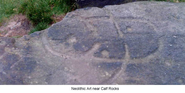
Over 250 rock carvings have been found within this area, and
some experts believe that there may be more buried under the
peaty soil. The rock carvings are found on cliff faces,
especially near Cow and Calf rocks, and also on the boulders
around the area of Green Crag Slack (Map Ref: SE1340). The local
rock is known as Millstone Grit, a brownish-grey rough soft stone
imbedded with quartz fragments. One question you'll hear from
nearly every visitor is: "What do the carvings
represent?" and can we find a cognitive thread of an Ancient
Briton's mind through the glyphs etched onto the rock?
These carvings are referred to as 'cup and ring' marks and are
more prevalent in the north of England. [See Exploring Northumberland's Rock Art, by Teri
Gray.] Patterns vary from region to region; as some are angular
or geometric, curved, and circular, while some have horseshoe
patterns. One of the theories put forward by antiquarians and
archaeologists is that these patterns may have been territory
markers or configurations representing a spiritual deity -- but
there is still plenty of room for other interpretations!.
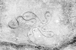 One of the most
well known artifacts in the area is the 'Swastika Stone,'
situated near Hebers Ghyll, thought to date around 1800BC.
Surrounded by iron railings, it can still be viewed without any
restriction. Similar designs have been found in Sweden and Italy,
and are thought to be one of the earliest forms of Celtic
art. One of the most
well known artifacts in the area is the 'Swastika Stone,'
situated near Hebers Ghyll, thought to date around 1800BC.
Surrounded by iron railings, it can still be viewed without any
restriction. Similar designs have been found in Sweden and Italy,
and are thought to be one of the earliest forms of Celtic
art.
1.5 miles south from Ilkley Crags, follow the path marked 'Dales
Way' (a gradual climb if you take the path at the side of Ilkley
Crags). All being well you should arrive at what is described as
a Druidical stone circle known as The Twelve Apostles Stone
Circle (Map Ref: SE12645). It is about 2000 years old, 52
feet in diameter with twelve 4-foot high stones. Originally,
there were twenty stones with a seven-foot megalith in the
centre. It is still used, like Stonehenge, for winter and summer
solstice celebrations. The stones have been dislocated and are
propped back by smaller rocks. It has good vantage point to the
south looking over the Aire valley.
Legend states that is impossible to count the stones at the first
attempt. Other tales over the decades involve sightings of
floating white spheres among the stones. One such account
happened in 1976, when members of the Royal Observer Corps
followed a white ball three feet in diameter weaving around the
stones.
Romans in Ilkley
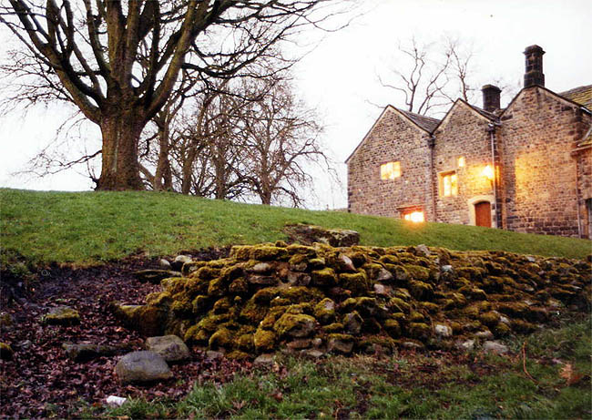
Romans arrived in the region in 79AD, and built a fort on the
southern side of the River Wharfe. The site is now occupied by an
Elizabethan manor house, which is also a museum. Sections of the
original Roman wall can be found within the gardens. Another
segment of the fort can be found near All Saints Church. One
theory is that Ilkley inherited its name from the Romans, who
named the fort Olinica, but modern scholars have doubted this.
An altar stone dedicated to the Romano-British water goddess
Verbia was discovered hidden under the steps of a house. It
contains the inscription.
Verbiae Sacrum Clodius Fronto D Praef. Coh
II Lingon
(To sacred Verbia.Clodus Fronto, Prefect of
Cohort, Second Legion).
Legend has it that Fronto was saved from drowning near one of
the whirlpools in the River Wharfe. Out of gratitude, he
established an altar dedicated to the goddess Verbia. The
original could not located, but a copy can be seen at the Manor
House Museum along with three other Roman altars, which can be
found in side the parish church.
The Roman occupation lasted 300 years, whereupon the legions were
recalled to defend Rome from the marauding tribes of Goths, Huns,
Vandals, and Celts. The new invaders who settled in and around
the town were the Angles, Saxons and Danes. All Saints Church was
established before the Norman Conquest, and within the church are
three Saxon crosses.
During the Middle Ages, the swamps were drained and gradually
dwellings were constructed. The earliest recorded is the Manor
House, whose foundations date to the 12th century. The building
material was available and within arms reach from the dilapidated
Roman fort, which provided sufficient stone to build the Manor
House and enough to spare to rebuild All Saints Church.
Taking the Waters
In the 1700s, Ilkley's identity as a spa town began at White
Wells, which is situated half way up Ilkely Moor. The whitewashed
building you see now was originally only a two-roomed cottage.
According to the local history, around 1780 a shepherd had an
accident and severely damaged his leg. The wound refused to
heal. But by daily immersion in the 'waters of Ilkley', the wound
began to heal itself. Soon White Wells began to receive visitors
seeking the therapeutic properties of the water. One of many
famous recipients who took the plunge into the healing waters is
Charles Darwin. He bathed here while his book Origin of the
Species was being published. Other famous visitors also
include Charles Dickens and Alfred Tennyson.
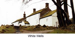 The modern White Wells is now a café serving
hot beverages rather than cold baths (if you stop here for a
'brew' be sure to have small change handy). You will find the
natural spring water at the back of the premises, still flowing
and people are able to tap the source of the 'miracle cure' for
themselves, so do not forget your water bottle. The modern White Wells is now a café serving
hot beverages rather than cold baths (if you stop here for a
'brew' be sure to have small change handy). You will find the
natural spring water at the back of the premises, still flowing
and people are able to tap the source of the 'miracle cure' for
themselves, so do not forget your water bottle.
Ilkley's reputation as a spa town associated with polite society
and prosperity increased in the 19th century. An Ilkley merchant,
travelling in Europe in1839, met a farmer in Silesia. The farmer
rented a hut in his field to the merchant-- and the field just
happened to sit on top of a natural brine spring. On his return
to Ilkley, this merchant developed the idea of utilising the
local source in a new way, and between 1840 and 1870,
hydrotherapy clinics began to spring up around the area. Visitors
used the recently formed railway network and would flock into the
town to take the waters. Hotels and guesthouses were built to
accommodate the tourists. Even the developments such as the
wooded plantations in Mill Ghyll and Hebers Ghyll were
landscaped for Victorian visitors.
Today, you can acquire the same elegance with modern facilities,
along with teashops and award-winning restaurants and pubs. The
town caters for both the outdoors person and today's
sophisticated tourist.
Related Articles:
- Exploring Northumberland's Rock Art, by Teri Foster Gray
- https://www.timetravel-britain.com/articles/stones/rockart.shtml
More Information:
We regret that we no longer have the resources to maintain up-to-date links and/or hours and pricing details for the various sites and attractions listed on this website. For more information about the location(s) listed above, please use your favorite search engine or visit Wikipedia.
John Abraham holds a degree in archaeology from the University of Manchester, and specializes in the prehistory of Northern Europe. He currently works as an administrative officer for the Department for Work and Pensions, and is developing a local guidebook on the ancient sites within a 30-mile radius of the Manchester area.
Article and photos © 2006 John Abraham
| 